Thunderstorms Expected Ahead of Tonight’s Orioles-Mariners Game; Severe Weather Risk Low in Maryland
A cold front sweeping through Maryland is triggering thunderstorms this afternoon and evening, with the potential for a few strong storms and locally heavy rain. Forecasters say most areas should dry out overnight, but the risk of a storm remains in play into the early evening.
Key timing from the forecast:
– Early to mid-afternoon: Thunderstorms could fire up farther west as the front approaches.
– Around 5 p.m.: A broken line of showers and storms may develop ahead of the front and race through the region.
– Tonight: Most areas trend dry after the storms move through, with clearing skies expected late tonight into Thursday.
– Thursday morning: Partly cloudy and dry to start the day; another shower or storm is possible in some areas, but activity should lessen as the day progresses.
– Overnight and into Friday: Quiet, with high humidity continuing.
Severe weather risk:
– The threat for severe weather is on the low end. Much of Maryland is under a marginal risk, meaning isolated severe storms are possible but not guaranteed.
– If storms do form, they could produce damaging wind gusts, frequent lightning, and very heavy rainfall with potential localized flooding.
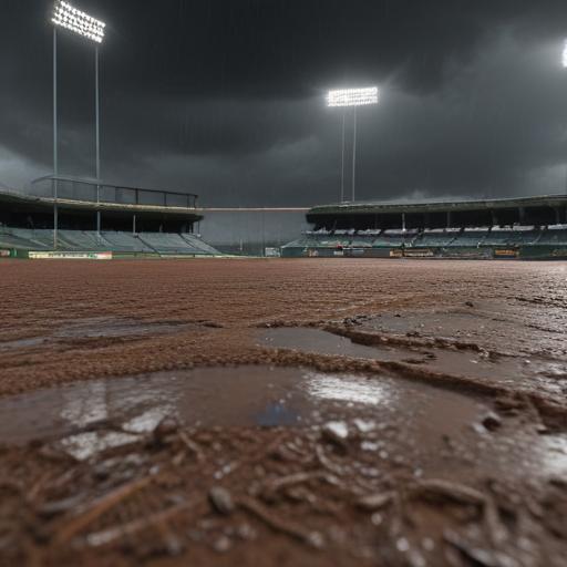
Impact on today’s game:
– Tonight’s Orioles game starts at 6:35 p.m. There is a chance for scattered thunderstorms around game time, which could delay play. Some lingering showers are possible around 9 p.m., but conditions should dry out as the evening wears on.
Forecast details:
– Highs today in the mid to upper 80s, with a few spots potentially touching 90.
– Tonight’s temperatures will fall into the 70s, dipping to the low to mid-70s by Thursday morning.
– The overall pattern remains warm and humid.
Tropical Storm Erin:
– Erin remains well out in the Atlantic but is expected to strengthen over the next couple of days and could move through or near the northern Lesser Antilles by the weekend.
– Forecasters say Erin has the potential to become our first major hurricane by Sunday, though track and intensity forecasts beyond a few days are inherently uncertain.
– Locally, the seven-day outlook calls for dry weather over the weekend with highs in the upper 80s.
What to watch and how to plan:
– If you’re heading to the ballpark, bring light rain gear and plan for the possibility of a weather delay. Stay tuned to local updates for any changes to the game status.
– Outdoor plans should include a quick weather check for storms, especially mid-to-late afternoon and early evening.
– Expect humidity to stay high even on dry days, and stay hydrated.
Summary:
A cold front brings scattered storms to Maryland today with a low risk of severe weather. The Orioles game could see weather-related interruptions, but most areas should dry out overnight into Thursday. By the weekend, the forecast points to calmer, dry conditions locally, though Tropical Storm Erin remains a potential distant threat that forecasters will monitor as it could grow into a major hurricane by Sunday depending on its path. Overall, a warm, humid stretch with intermittent thunderstorm chances remains the prevailing trend.