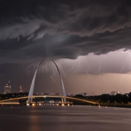
A Weather Impact Alert has been issued for the St. Louis area this evening, lasting overnight into early Tuesday due to the potential for severe weather conditions. The forecast indicates that while the risk is present for strong to severe storms, they are not expected to be as intense as those experienced on Friday.
Key threats include large hail, damaging winds gusting between 50-70 mph, and a limited chance of brief, weak tornadoes. Most of the region is categorized under a Slight risk (2/5) for severe weather, with certain counties elevated to an Enhanced risk (3/5). While the possibility for tornadoes exists, the majority of the significant tornado threats are set to be concentrated further west in Oklahoma and southwest Missouri.
The severe weather is anticipated to start impacting the area around 6 PM, with initial storms likely affecting counties in the west before reaching the metro area around 9-10 PM. Rainfall could hamper recovery efforts in the aftermath, as heavy thunderstorms are expected later in the evening. Overall, while this storm system carries the potential for severe weather, it is important to note that the conditions are not as severe as those witnessed last week.
Stay alert and be prepared for changing weather conditions during this timeframe, as storm chances increase tonight.