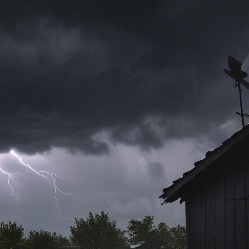
Severe thunderstorms are sweeping through East Tennessee, particularly affecting the Knoxville area. The National Weather Service issued a tornado warning for Knoxville, Oak Ridge, and nearby communities, which has since expired. So far, impacts have included a report of a downed tree in Powell, but no significant damage has been noted.
Severe weather is anticipated to continue on Tuesday afternoon and evening, with heavy rain, damaging winds, hail, and tornadoes expected to affect Knoxville and surrounding areas. Wind gusts could reach up to 70 mph, posing a substantial threat. In fact, Knoxville is under an “enhanced risk” for severe weather, highlighting the potential severity of the situation.
The storms are predicted to move in multiple rounds, with the first wave impacting regions like Sunbright, La Follette, and Chattanooga as early as 5 p.m. Knoxville, Gatlinburg, Tazewell, and Murphy may experience severe weather mainly between 9 p.m. and midnight, while Northeast Tennessee areas such as Greeneville and Mountain City should be prepared for impacts beginning around 8 p.m.
Residents should be aware that damaging winds, also known as straight-line winds, can cause significant hazards, including downing trees and power lines, damaging buildings, and disrupting services. Knoxville does not utilize outdoor tornado sirens due to their limitations, but officials encourage residents to rely on weather radios and mobile alerts for timely information about severe weather.
It’s crucial for residents to understand the difference between a tornado watch and a tornado warning. A watch indicates that conditions are suitable for tornadoes, while a warning means a tornado has been sighted or indicated by radar. In the event of a warning, individuals should seek immediate shelter in a basement or an interior room without windows.
This weather event serves as a reminder of the importance of preparedness. Taking the time to stay informed and make safety plans can significantly reduce risks during severe weather incidents.