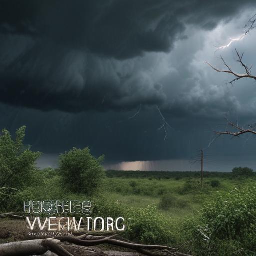
Severe thunderstorms are anticipated in the Kansas City region on Monday, with the National Weather Service (NWS) indicating that weather conditions may affect the formation of the most intense storms. The service has highlighted that if discrete supercell storms materialize in the afternoon, there is a potential for damaging winds, hail, and tornadoes.
The storms are expected to first develop as a warm front advances into the area. The NWS’s Storm Prediction Center has categorized Kansas City and its surroundings under an enhanced risk of severe weather, placing it at the third tier of a five-point scale.
Key to the development of severe weather will be the cloud cover; persistent clouds may prevent strong storms from forming, while clearing skies could allow for the emergence of powerful storms. Supercells, known for their dangerous rotating structure, can sustain themselves for several hours under favorable atmospheric conditions.
Following the initial storms, a second round is forecasted to develop in east-central Kansas between 3 PM and 5 PM. While initial formations may produce long-track storms, there’s uncertainty regarding whether they will remain isolated as they move eastward of the Kansas-Missouri border. The storms are then expected to consolidate, leading to damaged winds ranging from 60 to 70 mph, as well as the potential for large hail.
There is also a conditional threat for brief tornadoes arising along the leading edges of the storm segments. While flooding risks are present, the ground conditions were found to be less saturated than anticipated due to lighter rainfall on Sunday night, which may help mitigate flooding impacts across the Kansas City metro area. However, the NWS has warned that heavy rain could still occur, particularly in the southwestern parts of the forecast region.
Rainfall predictions suggest widespread amounts of 2 to 3 inches, with the metro area expecting between 1.5 and 2 inches, and some areas north and east of the city could see 3 to 4 inches. Following the storm system’s departure, a cool-down in temperatures is anticipated.
Weather patterns can be unpredictable, but it is hoped that the Kansas City community remains prepared while appreciating the natural forces at play, and local authorities continue to monitor the situation closely. The information provided by the NWS will be crucial for residents to stay safe and informed throughout the potential stormy weather.