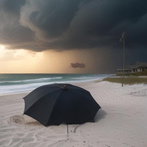
Southwest Florida is experiencing a stormy beginning to the week, with severe weather expected to continue throughout the day. The region is under a Gulf Coast Weather Impact Day, as stronger storms could bring heavy rainfall, intense lightning, strong wind gusts, and even small hail.
As storms developed, forecasters issued warnings for areas in Lee and Collier counties, highlighting the risk of gusty winds and small hail. Doppler radar is currently tracking heavy rainfall and significant lightning activity, with over 200 strikes reported. The storms are moving eastward at about 20 miles per hour, potentially affecting communities such as Babcock Ranch, Cape Coral, Suncoast Estates, and North Fort Myers by midday.
Expect rainfall and the possibility of severe weather conditions to persist into the evening, creating a slick commute. Continued moisture is anticipated to flow in from the Gulf, with the heaviest impacts likely occurring inland in Hendry and Glades counties.
Looking ahead, another Gulf Coast Weather Impact Day is expected tomorrow, with a level one out of five risk for severe storms across the region. Strong winds and small hail are possible, along with reports of gusts of up to 60 miles per hour in nearby Tampa Bay.
The good news is that, despite the current stormy weather, the National Hurricane Center reports no significant tropical development is expected for the next week. As hurricane season officially began over the weekend, one area of interest is off the U.S. East Coast, but any developments would pose no threat to Southwest Florida.
In the coming days, while the weather may remain unsettled, indications suggest that moisture levels may begin to taper down toward the weekend, offering a glimmer of hope for improved conditions.
Residents are encouraged to stay informed and take precautions as the storms continue to evolve.