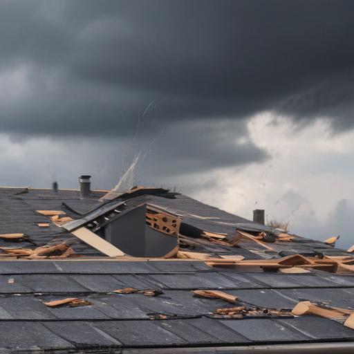
Thunderstorms sweeping through northern and central Iowa have caused scattered damage to trees and power lines, alongside significant disruptions to electrical service. At the storm’s height, MidAmerican Energy reported approximately 30,000 residences were without power.
The National Weather Service noted that gusty winds, reaching up to 60 to 70 miles per hour just after midnight, were responsible for much of the damage. Meteorologist Brooke Hagenhoff stated that as the storms moved southward into the morning, gusts continued between 40 and 50 miles per hour across central and southern parts of the state.
Despite the storm’s aftermath, the weather is set to become increasingly warm and humid. Hagenhoff warned that the combination of heat and humidity could push afternoon heat index values to dangerously high levels, between 105 and 110 degrees Fahrenheit. An Extreme Heat Warning will take effect at noon for western Iowa and the southern half of the state, with heat indices potentially soaring up to 115 degrees.
Fortunately, no injuries have been reported as a result of the severe weather. However, there is a light at the end of the tunnel; after enduring this oppressive heat on Tuesday, residents can expect a welcome relief, with temperatures expected to drop to the 70s across the entire state by Wednesday.
This pattern of swift weather changes serves as a reminder of Iowa’s dynamic climate. Residents should remain cautious but also feel reassured that relief from the heat is on the horizon.