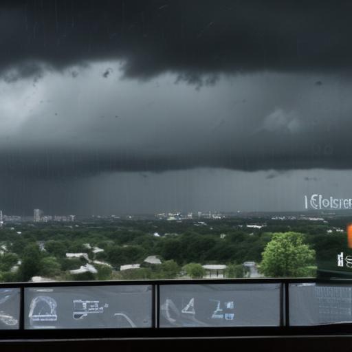
The Lower Hudson Valley is experiencing a rainy start to the week, particularly on Monday, July 14, with a flood watch issued for southern Westchester as areas brace for potential thunderstorms in the afternoon.
According to the National Weather Service, the Mid-Atlantic region is expected to see ample rainfall, raising concerns about flash flooding along the I-95 corridor, especially with rainfall rates anticipated to exceed two inches per hour in some areas.
The flood watch for southern Westchester is effective from 2 p.m. until midnight Tuesday, highlighting the risk of flash flooding due to the forecasted heavy rainfall that could occur within just a few hours. Urban areas with poor drainage and small rivers, creeks, and low-lying locations are particularly vulnerable to flooding.
In addition, Ramapo is projected to receive between 1 to 2 inches of rain on Monday, while Putnam County may see rainfall amounts ranging from half an inch to three-quarters of an inch. Areas like Yonkers in Westchester could receive up to an inch.
Looking ahead, the region will face continuing rainfall throughout the week coupled with rising temperatures. Highs are expected to reach the mid-80s on Tuesday, with the heat index in Brewster potentially exceeding 95 degrees. Wednesday is likely to bring even warmer temperatures in the upper 80s to low 90s, along with a chance of afternoon thunderstorms.
Despite the challenges of the weather, it is hopeful that the precipitation will help ease some of the dryness in the region and support local flora and agriculture. The community is encouraged to stay informed about changing weather conditions and to take necessary precautions against potential flooding.