First Alert Weather Days stay in effect through Monday as a heat wave persists, keeping nights uncomfortable for those without air conditioning. Forecasters say relief is on the way, with a cooldown arriving midweek.
Weekend heat recap
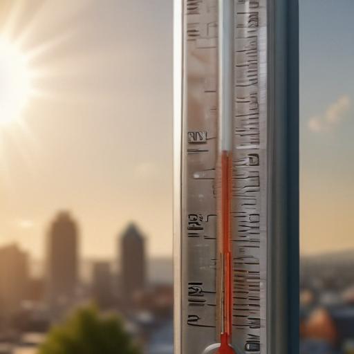
– Friday brought the first 100-degree day of the year in Portland, with a high of 102°, and several other metro areas tied or set daily records (Vancouver, Hillsboro, McMinnville, Salem, and Eugene also reached new or tied highs).
– Saturday topped 100° at Portland International Airport, marking two consecutive 100-degree days—the latest such stretch on the calendar since 2016. The daily high at PDX did not set a new record (the record is 101° from 1988), but other sites did see record or near-record heat: Hillsboro hit 101° (new daily record), Vancouver 100° (daily record), McMinnville 100°, and Troutdale 102°.
What to expect in the days ahead
– Sunday and Monday will ease only slightly, with highs in the mid to upper 90s. Tuesday looks hot again, though increased cloud cover could keep temperatures closer to the 90s.
– A more notable relief arrives Wednesday, with highs dropping into the mid to upper 80s.
– Overnight heat remains stubborn. Portland’s Sunday morning low around 65° ties for the warmest on August 23, and most nights will stay in the mid to upper 60s through Wednesday. An east wind that helped keep conditions hotter will ease away by Sunday.
Current and upcoming warnings
– Extreme Heat Warnings and Heat Advisories remain in effect through the weekend. If you’re feeling hot at home, seek cooler spaces and stay hydrated.
– Cooling shelters are available for those without reliable cooling options. Limit strenuous outdoor activity from noon to 7 pm, check on vulnerable neighbors and family members, and remember that heat is a leading weather-related hazard.
Looking ahead to next week
– A high-pressure system will gradually loosen its grip, allowing cooler marine air to move inland. Expect lingering 90s through Tuesday, with more noticeable cooling by the end of the week.
– Forecasters are watching for shower chances by Friday as a weather system approaches.
Summary
– The region experienced record-setting heat over Friday and Saturday, with a stretch of two consecutive 100-degree days extending later than usual. A cooldown is forecast to begin midweek, bringing relief from the heat and a return to more comfortable temperatures. Stay updated with the latest alerts and plan accordingly to stay cool and safe.
Helpful notes to riders and residents
– If you rely on air conditioning, run fans and keep curtains closed during peak sun to reduce indoor heat.
– Hydrate regularly and avoid outdoor activity during the hottest part of the day.
– Check on elderly neighbors, young children, and pets during heat spells.
– Consider visiting cooling centers or public facilities if your home remains uncomfortably warm.
Overall outlook
– Positive spin: While the current heat is intense, the midweek cooldown offers welcome relief, especially for schools opening next week and residents seeking relief from overnight heat. The pattern suggests a more comfortable end to the week with chances of showers Friday as a system approaches.