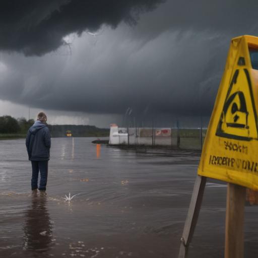
Severe weather has begun impacting the Northeast and mid-Atlantic regions, with dangerous flash flooding reported along the Interstate 95 corridor on Thursday. Millions are preparing for torrential rain as a cold front moves through the area, providing some relief from the recent intense heat.
Flash flooding first emerged early Thursday afternoon in Maryland, where multiple water rescues were conducted in Joppatowne, located north of Baltimore. As of 2:15 p.m., the National Weather Service reported that between 2 and 4 inches of rain had fallen northeast of Baltimore. The potential for flooding is expected to escalate as storms develop throughout the day, especially during the afternoon.
New York City Mayor Eric Adams advised residents to remain vigilant for the approaching storm. He announced a Flood Watch effective from 2 p.m. and a Travel Advisory, urging residents to limit travel and implement flood prevention measures. Meanwhile, acting New Jersey Governor Tahesha Way declared a state of emergency for the state following forecasts predicting up to 7 inches of rain in some areas. She encouraged residents to stay alert and adhere to safety protocols.
This warning for severe weather follows a previous incident where heavy rain led to two fatalities in New Jersey. During that storm, New York City recorded its second-wettest hour in history, with over 2 inches of rainfall within just 60 minutes.
Flights are experiencing significant delays at major airports, including Philadelphia International and New York’s JFK and LaGuardia, due to the ongoing thunderstorms.
The cold front is expected to bring heavy rains at rates of up to 3 inches per hour, contributing to the flood risk. The FOX Forecast Center indicates that rainfall amounts could reach between 2 to 4 inches, with localized areas possibly receiving 5 to 8 inches, especially where storms are most intense.
Flood Watches are currently in effect from Virginia to Connecticut, affecting cities like Washington, Philadelphia, and New York City. NOAA’s Weather Prediction Center has categorized the flood risk at Level 3 out of 4 for approximately 23 million individuals in the region.
In addition to flooding, there is a risk of severe thunderstorm activity, with parts of Pennsylvania, New Jersey, Delaware, Maryland, Washington, and Virginia also receiving a Level 2 risk rating on the severe thunderstorm scale. The FOX Forecast Center highlighted that the afternoon heating combined with high dew points could trigger thunderstorms that may develop into supercells, posing risks of damaging winds above 60 mph and large hail.
Residents are urged to stay informed and ready as this potentially hazardous weather unfolds, with safety remaining a top priority as storms roll in.