Invest 98L could bring heavy rain and minor flooding to South Texas and the Texas Gulf Coast this weekend, even as it may not become a named storm
A tropical disturbance in the western Gulf of Mexico, designated Invest 98L by the National Hurricane Center, is likely to produce downpours and an elevated flood risk for South Texas and areas along the Texas Gulf Coast by Friday. Forecasters say the system has a 40% chance of developing into a tropical cyclone in the next two days.
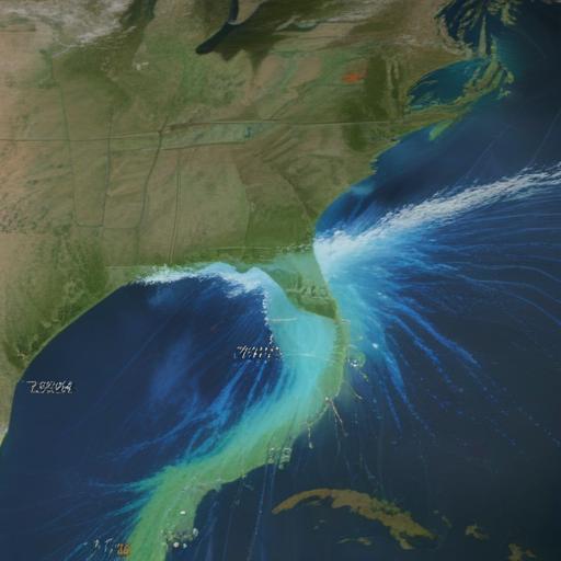
What’s heading toward land
Invest 98L will stay over warm Gulf waters for the next 24 to 48 hours, where sea-surface temperatures are around 86 degrees Fahrenheit—ample warmth for tropical development, though overall conditions are only marginally conducive. A brief tropical depression could form before landfall. Most forecast models project the disturbance to come ashore between Brownsville and South Padre Island Friday night or Saturday morning, with landfall most likely in northern Mexico or South Texas.
Although the system is not expected to become a named storm, the next name on the 2025 Atlantic hurricane season list is Fernand.
Coastal flood risk and rainfall
A plume of deep tropical moisture associated with Invest 98L is forecast to pull into southern Texas on Friday, bringing the potential for heavy rainfall from the South Texas coast northward to Beaumont and the Houston metro area. The Weather Prediction Center places the region at a low risk for flash flooding (level 1 of 4, about a 5% chance). Most of the upper Texas Gulf Coast is expected to receive less than an inch of rain, with higher totals closer to the coast and during the heaviest downpours in the afternoon and evening.
Officials stress this isn’t the rain pattern that followed Tropical Storm Barry’s impacts in the Hill Country last month. There is no Pacific moisture connection this time, and a ridge of high pressure is expected to curb rain chances across the Hill Country by Sunday.
Erin remains a concern in the Atlantic
Tropical Storm Erin is currently swirling in the open Atlantic, about 990 miles east of the northern Leeward Islands as of Thursday morning. Erin is forecast to become the season’s first hurricane by Friday afternoon, with potential rapid intensification by late Saturday or early Sunday. The forecast cone shows Erin possibly weaving between the East Coast of the United States and Bermuda late next week, so travelers from Miami to Bangor should monitor updates over the next seven to ten days.
What to watch and how to stay ready
– Focus on the Texas Gulf Coast and South Texas for potential rainfall and minor flooding Friday into Saturday; monitor local forecasts for any changes in timing or intensity.
– If you live along affected coastal areas, prepare for possible street flooding in low-lying, poorly drained areas. Do not drive through flooded roads.
– Keep an eye on Erin’s progress, as it could affect shipping routes, beach conditions, and outdoor plans along the East Coast and Bermuda later next week.
– Stay tuned for updated forecasts from the National Hurricane Center and local Weather Prediction Center advisories as the weekend approaches.
In brief
Invest 98L brings the potential for heavy rain and minor flooding along the Texas Gulf Coast this weekend, with isolation of stronger impacts near the coast. Erin is on a separate track in the Atlantic and could become the first hurricane of the season, warranting close monitoring for broader impacts late next week. A cautious approach and timely forecast updates will help residents and travelers plan accordingly.