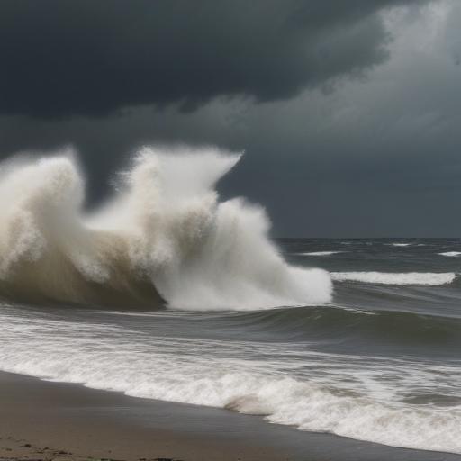
Hurricane Erin keeps Massachusetts on alert for high surf and rip currents, but its center remains well offshore
Massachusetts residents are being told to expect rough surf, strong currents and breezy conditions as Hurricane Erin remains a powerful system well off the coast. The latest advisory places Erin as a category two hurricane with winds around 105 mph, moving northeast at about 17 mph. Its closest approach to New England will be more than 300 miles offshore tomorrow morning, reducing direct impacts on land but leaving a lingering danger zone along the shore.
What to expect
– Beach and ocean conditions: A high surf advisory is in effect through Saturday at 8 p.m. Large waves are expected to push nearshore up to 8 to 18 feet, with the biggest surf on the south-facing beaches. Expect continued rough seas as the storm churns farther away, with the outer bands brushing the Cape and Islands and then the East-facing beaches late in the week.
– Rip currents and shore hazards: A high risk of rip currents will persist through Saturday, with a possible drop to a moderate risk on Sunday. Beach erosion is anticipated on south-facing beaches, and there could be minor coastal flooding around tonight’s high tide on the islands.
– Winds and coastal impact: Wind gusts on the Cape and Islands could reach 40 to 50 mph tomorrow afternoon, with a strong northeast breeze keeping coastal areas cooler. The strongest winds are expected to taper after midday tomorrow as Erin moves away.
– Rain and clouds: Recent rainfall varied across the region, with some southern Worcester County towns picking up more than an inch and Boston closer to a half-inch, while other areas saw less. The rain is expected to end on the Cape by around 9 to 10 a.m. as Erin’s western cloud shield passes.
– Temperatures: Today’s highs will be in the 60s inland and around the 50s along the coast under persistent clouds. Inland areas may reach lower 70s, while coastal regions stay cooler due to the breeze.
Forecast outlook
– Friday into the weekend: Skies should brighten Friday afternoon with improving conditions. By Saturday and Sunday, sunshine returns for most, with seasonal warmth returning — highs bouncing into the 70s inland and the 80s in some parts of the region.
– Next week: A chance of showers and thunderstorms may return Monday as the weather pattern shifts.
What this means for you
– If you’re planning a beach day, exercise extreme caution. Stay out of the water during rough surf or if you’re not a strong swimmer, and heed any local advisories or lifeguard warnings.
– Check tide times and avoid coastal areas during high tide when minor flooding is possible.
– Boaters should monitor marine forecasts closely and avoid exposed coastal areas during peak wind and wave periods.
Summary
Erin’s far-off track is still generating dangerous surf and rip currents along the Massachusetts coast through the weekend, with wind gusts and possible coastal erosion on south-facing beaches. The good news is that conditions are expected to gradually improve into next week, bringing brighter skies and warmer temperatures.
A note for readers: This storm demonstrates how large offshore systems can continue to affect coastal conditions long after the center has moved away, underscoring the importance of heeding weather advisories and staying vigilant at the shore.
Optional addition
– If you’re drafting social media teasers or quick alerts, emphasize: “Erin remains offshore but keeps MA beaches risky through Saturday. High surf and rip currents large; plan accordingly and stay updated on the latest forecasts.”
