Potential Gulf system could become Fernand, with possible landfall in Texas or Mexico before Erin threatens land
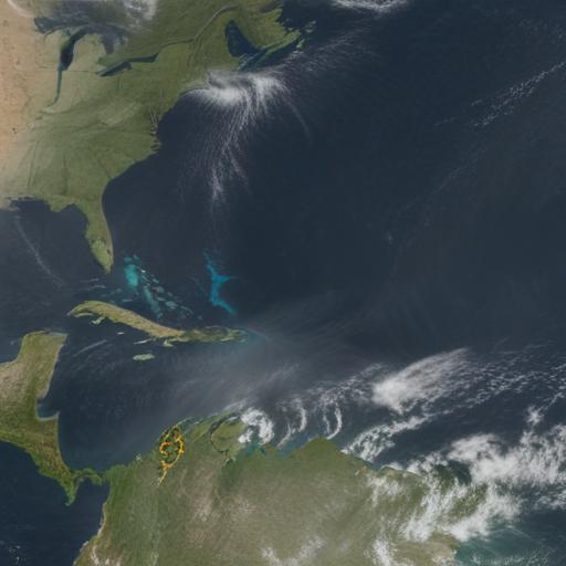
A cluster of thunderstorms in the western Gulf of Mexico is being watched for potential tropical development. The system is not yet organized, and it is not a tropical storm at this time, but forecasters say there is at least a medium chance it could form into a named storm.
If it does form, the storm would be named Fernand, the sixth named storm of this year’s Atlantic hurricane season.
Most likely, the system would first become a tropical depression, meaning it shows some tropical structure but its winds would stay below 39 mph, not yet meeting the threshold for a tropical storm.
Two hurricane hunter missions were active in relation to this development: one flight was en route to the middle of the Atlantic to study Erin, while another sampled the Gulf cluster to assess its potential organization and intensity.
The forecast suggests there could be a landfall threat on the Texas coast or portions of northern Mexico, potentially occurring before Erin poses any land threat. However, the track and intensity remain uncertain, and factors such as wind shear, dry air, and overall atmospheric conditions could hinder development.
Additional context and preparation: residents along the Gulf Coast should monitor forecast updates closely, secure loose objects, review family evacuation plans, and stay informed through official weather advisories. Even if the system strengthens, rapid changes in intensity are possible, so preparedness is key.
In short, a Gulf-area disturbance is being watched for possible development into Fernand, with the potential to bring tropical conditions and local impacts to Texas and northern Mexico before Erin becomes a concern. Stay tuned for updates as forecasters refine the track and timing.