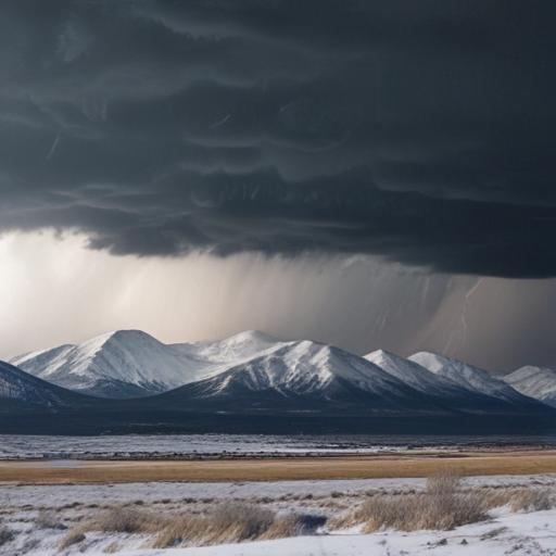
A significant change in Colorado’s weather is imminent as a cold front approaches, following a period of warm, summer-like conditions. According to the latest forecasts, this front is expected to arrive Wednesday afternoon, bringing with it scattered showers and a chance of thunderstorms across the state, particularly affecting areas along and north of Interstate 70.
While precipitation may vary, many regions along the Front Range and the Northeastern Plains might experience wet weather. The morning is anticipated to be dry with cloud cover progressively increasing. Mountains are likely to see rain and snow first, with moisture expected to reach lower elevations by mid-afternoon.
There is a possibility that some thunderstorms could produce damaging wind gusts and small hail, especially in the Northeast region, which has been designated under a Level 1 Marginal risk for severe weather. Storms in this area could generate wind gusts of up to 65 mph.
Alongside the front’s arrival, strong winds are anticipated across Colorado. Gusts in the Denver metropolitan area could reach 25-35 mph, while the mountains and foothills might face even stronger gusts of 70-75 mph late tonight and early tomorrow morning.
As temperatures drop back into the 70s for the Denver metro area, this change aligns well with seasonal expectations for the region, providing a reminder of the dynamic nature of Colorado’s weather.