
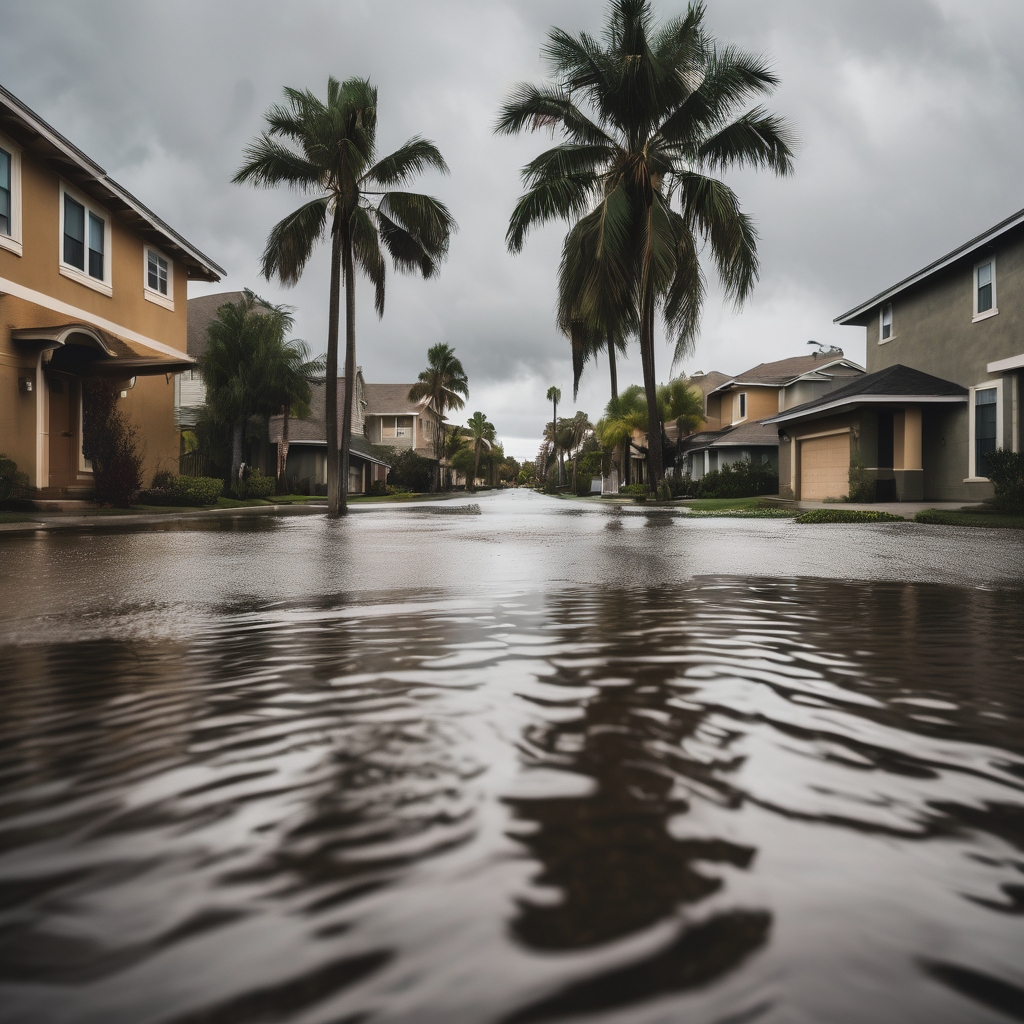
A significant storm is making its way into Southern California, and residents are advised to brace for potentially hazardous conditions over the next four days. The National Weather Service (NWS) predicts that rainfall amounts could range between 2 to 5 inches in most areas, with certain coastal slopes, particularly in recently burned zones, anticipating up to 8 inches. This poses heightened risks for debris flows, especially in vulnerable regions.
The storm’s heaviest rainfall is expected to strike Santa Barbara Thursday night, gradually moving southward into Los Angeles by late Friday or early Saturday. As part of safety precautions, evacuation warnings have been issued for areas affected by past fires, including Kenneth, Palisades, Eaton, and Canyon burn scars in Los Angeles County. Precipitation rates could surpass half an inch per hour, prompting local officials to advise residents to be ready to evacuate.
In addition to the rain, threats of flash floods, roadway closures, and even small tornadoes loom. Travelers departing from Los Angeles International Airport (LAX) should anticipate flight delays due to strong winds forecasted for Friday and Saturday.
A flood watch is in effect from midnight on Friday through noon for Santa Barbara and Ventura counties, reflecting the seriousness of the approaching storm. A secondary flood watch will be effective for Santa Barbara, Ventura, and Los Angeles counties on Saturday between 4 a.m. and 10 p.m. The average November rainfall for downtown Los Angeles is 1.23 inches, making this storm’s forecasted 5 inches exceptionally high.
Weather forecasters describe the storm as a cutoff low, a low-pressure system that deviates from typical jet stream patterns, making predictions challenging. Updated estimates may alter as the storm develops, with a possibility that the rainfall for Los Angeles could fall under 2 inches.
As for wildfires, the conclusion of the fire season relies heavily on the total rainfall from this storm. Typically, the NWS designates the end of fire season when a widespread accumulation of 3 to 4 inches of rain has been observed throughout the area.
Rainfall estimates from the NWS for the upcoming storm include:
– Santa Maria: 3.18 to 4.23 inches
– Santa Barbara: 4.2 to 5.6 inches
– Downtown L.A.: 2 to 4.8 inches
– Long Beach Airport: 2.5 to 4.22 inches
– Orange County: 3 to 4 inches
– Oceanside: 2.5 to 3 inches
– Riverside: 2 to 2.5 inches
– San Bernardino: 2 to 2.5 inches
– Joshua Tree: 1.5 to 2 inches
– Escondido: 2 to 2.5 inches
To enhance public safety, authorities recommend residents sign up for local emergency alert systems, such as Alert L.A. County, which currently has only 1.6 million subscribers out of approximately 7.8 million adults in the area. This alert system serves as a crucial method for disseminating timely evacuation orders.
Public awareness is paramount during such weather events. Individuals should remain informed about emergency services via local agency social media channels and follow essential driving safety practices during rain.
As Southern California navigates the tumultuous weather ahead, residents are encouraged to prepare and remain vigilant, ensuring that they stay connected and informed for their safety and well-being.